|
Location and geography
Introduction
The area under prospecting is Kakini Hills, consisting of six blocks as
identified on the topographic map in accordance with the Ministry of Solid
Minerals Development mining lease.
 |
| |
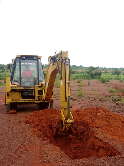
Backhoe loader digging a pit for sampling |
|
After intensive exploration in this area by geological mapping, washing of soil samples from several test pits and exploration trenches around Kakini Hill and observation from pits dug by the
local artisan miners, we discovered that it is an alluvial deposit of gold.
Gold accumulates in various blocks in the northern part of the area. A
primary deposit of gold with quartz veins was discovered during the
exploration.
Location and Transportation of
Exploration Area
The prospecting area occupied is 4km2 covering Kakini Hills and Yankan Dutse
villages, in the Birnin Gwari L.G.A. of Kaduna state. The location on the
topographic map of scale 1:50000 of sheet 100 S.E. Kwaimbana. The location on
geological map is on the northern part of Nigeria and about 90 km from Kaduna
town by asphalt road. The main road passing through the area is motorable in
any season.
Geography and Topography
The area is flat and a little undulating with elevation decreasing from the
northern and eastern part to Kwahu River on the west. The west side of the
area is a river basin plain of seasonal river with one tributary called
Damari River about 4 km long.
The Kakini Hill is situated on the northern part lying in N-S trend. There
are three villages in the area which have few houses.
 |
| |
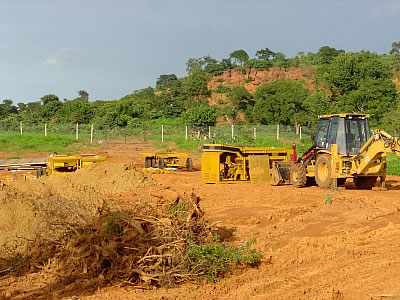
Plant installation in progress at Kakini
Hills site |
|
All the lands in the
area are farmlands except around Kakini Hill which has some bush and
grassland. The temperature is 30-350c in the day time and 24-250c at
nighttimes.
Previous Exploration
There is no detailed exploration report of this area, except for the
geological map of Nigeria scale 1:2 000 000 and notes of the history of
geological survey in Nigeria.
|